Trail Walking Chelles - Chelles le Mont-Chalâts - Photo

Chelles le Mont-Chalâts

 destras
destras

User

© OpenStreetMap contributors
Length
Length
7.3 km
Max alt
Max alt
108 m
Uphill gradient
Uphill gradient
130 m
Km-Effort
Km-Effort  
9.1 km
Min alt
Min alt
43 m
Downhill gradient
Downhill gradient
134 m
Boucle
Boucle
Yes
Creation date :
2016-03-09 00:00:00.0
Updated on :
2016-03-09 00:00:00.0

(0 Reviews)

Walking
Walking
1h30
Difficulty : Medium

Scan this QR Code to open this trail in the SityTrail application

FREE GPS app for hiking

Logo SityTrail SityTrail

IGN / Geographical institutes

Download SityTrail from the App Store Download SityTrail from Google Play

Logo SityTrail SityTrail World

The world is yours!

Download SityTrail from the App Store Download SityTrail from Google Play Download SityTrail on Huawei AppGallery

About

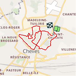
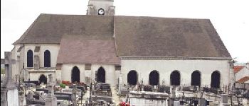
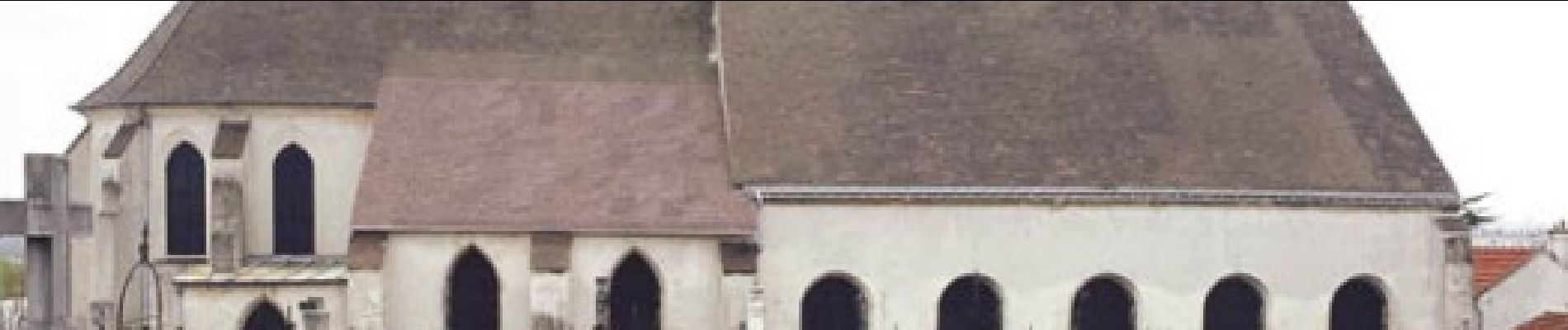
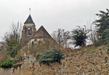
Trail Walking of 7.3 km to be discovered at Ile-de-France, Seine-et-Marne, Chelles. This trail is proposed by destras.

Description

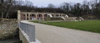
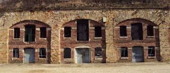
Tours et détours au Mont-Chalâts. Après avoir parcouru ces sentiers, on comprend mieux pourquoi ont dit dans le coin que l'on monte à la montagne de Chelles

Elevation profile

Photos

Points of interest

Point of interest Chelles - Le fort - Photo
destras
CHELLES 
Point of interest Chelles - Le fort de près  - Photo
destras
Point of interest Chelles - l'église saint-andré - Photo
destras

Positioning

Country:
France
Region :
Ile-de-France
Department/Province :
Seine-et-Marne
Municipality :
Chelles
Location:
Unknown
Start:(UTM)
471178 ; 5414827 (31U) N.

Trails nearby

Trail Walking Chelles - GRP CV-IDF 06 - Photo
Walking
clalaur

Walking

Medium
(1)
Chelles, Ile-de-France, Seine-et-Marne, France
15 km | 16.7 km-effort
3h 47min
No
Trail Walking Saint-Thibault-des-Vignes - Du Parc de Rentilly au Vallon de la Brosse - Photo
Walking

Walking

Medium
(4)
Saint-Thibault-des-Vignes, Ile-de-France, Seine-et-Marne, France
9.8 km | 11.3 km-effort
2h 33min
Yes
Trail On foot Bussy-Saint-Georges - Du Parc de Rentilly au Vallon de la Brosse - Photo
On foot

On foot

Very easy
(1)
Bussy-Saint-Georges, Ile-de-France, Seine-et-Marne, France
5 km | 5.8 km-effort
1h 55min
Yes
Trail Walking Chelles - Bords de Marne de Chelles à Neuilly-sur-Marne 4/5 * 11km - Photo
Walking
GUIDE
Rui Barbosa

Walking

Easy
Chelles, Ile-de-France, Seine-et-Marne, France
11.2 km | 12 km-effort
2h 43min
Yes
Trail Walking Noisiel - Noisiel Grand parcours - Photo
Walking
CC.RIDER

Walking

Easy
(1)
Noisiel, Ile-de-France, Seine-et-Marne, France
21 km | 23 km-effort
4h 50min
Yes
Trail Walking Bussy-Saint-Georges - Boucle Rentilly - Noisiel - Etang de la Brosse - Etang de la Loy - Photo
Walking
chessyca

Walking

Very difficult
Bussy-Saint-Georges, Ile-de-France, Seine-et-Marne, France
25 km | 29 km-effort
6h 32min
Yes
Trail Walking Vaires-sur-Marne - Boucle Vaires sur Marne / Noisiel / Chelles - Photo
Walking
chessyca

Walking

Easy
Vaires-sur-Marne, Ile-de-France, Seine-et-Marne, France
21 km | 24 km-effort
4h 33min
Yes
Trail Walking Montfermeil - GRP CV-IDF 11R Montfermeil à Chelles - Photo
Walking
clalaur

Walking

Medium
Montfermeil, Ile-de-France, Seine-Saint-Denis, France
10.3 km | 11.9 km-effort
2h 42min
No
Trail On foot Gournay-sur-Marne - PR des Bords de Marne - Photo
On foot
PRO

On foot

Easy
Gournay-sur-Marne, Ile-de-France, Seine-Saint-Denis, France
7.3 km | 8 km-effort
1h 48min
No


Close
My subscriptions