


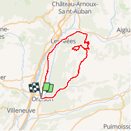
Oraison - Mées

lviallet
User

Length
55 km

Max alt
828 m

Uphill gradient
802 m
Km-Effort
65 km

Min alt
365 m

Downhill gradient
802 m
Boucle
Yes
Creation date :
2016-09-21 00:00:00.0
Updated on :
2016-09-21 00:00:00.0
3h41
Difficulty : Difficult

FREE GPS app for hiking
 SityTrail
IGN / Geographical institutes
SityTrail Plus
The world is yours!
About
Trail Cycle of 55 km to be discovered at Provence-Alpes-Côte d'Azur, Alpes-de-Haute-Provence, Oraison. This trail is proposed by lviallet.
Description
Superbe balade mais sans voir la ferme aux panneaux solaires.
A refaire...
Positioning
Country:
France
Region :
Provence-Alpes-Côte d'Azur
Department/Province :
Alpes-de-Haute-Provence
Municipality :
Oraison
Location:
Unknown
Start:(Dec)
Start:(UTM)
734296 ; 4866705 (31T) N.
Comments