


Bassi de Saint-Féréol

frizou83
User

Length
36 km

Max alt
381 m

Uphill gradient
383 m
Km-Effort
40 km

Min alt
191 m

Downhill gradient
220 m
Boucle
No
Creation date :
2016-03-09 00:00:00.0
Updated on :
2016-03-09 00:00:00.0
2h21
Difficulty : Unknown

FREE GPS app for hiking
 SityTrail
IGN / Geographical institutes
SityTrail Plus
The world is yours!
About
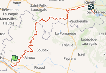
Trail Cycle of 36 km to be discovered at Occitania, Aude, Montferrand. This trail is proposed by frizou83.
Positioning
Country:
France
Region :
Occitania
Department/Province :
Aude
Municipality :
Montferrand
Location:
Unknown
Start:(Dec)
Start:(UTM)
404604 ; 4800470 (31T) N.
Comments