


Alpine Crossing Tongarino

zoe.vienne
User
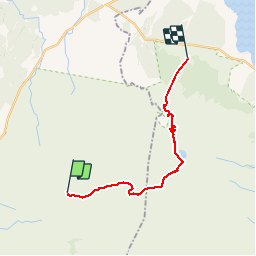

Length
19.6 km

Max alt
1856 m

Uphill gradient
809 m
Km-Effort
32 km

Min alt
750 m

Downhill gradient
1180 m
Boucle
No
Creation date :
2016-02-04 00:00:00.0
Updated on :
2016-02-04 00:00:00.0
6h36
Difficulty : Difficult

FREE GPS app for hiking
 SityTrail
IGN / Geographical institutes
SityTrail Plus
The world is yours!
About
Trail Other activity of 19.6 km to be discovered at Manawatu-Whanganui, Ruapehu District. This trail is proposed by zoe.vienne.
Description
Magnifique
Positioning
Country:
New Zealand
Region :
Manawatu-Whanganui
Department/Province :
Ruapehu District
Municipality :
Unknown
Location:
Unknown
Start:(Dec)
Start:(UTM)
377372 ; 5666254 (60H) S.
Comments