


Canal du Midi - Etape 1

frizou83
User
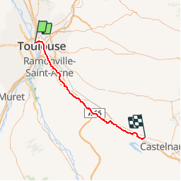

Length
55 km

Max alt
200 m

Uphill gradient
430 m
Km-Effort
61 km

Min alt
135 m

Downhill gradient
380 m
Boucle
No
Creation date :
2016-03-09 00:00:00.0
Updated on :
2016-03-09 00:00:00.0
3h28
Difficulty : Unknown

FREE GPS app for hiking
 SityTrail
IGN / Geographical institutes
SityTrail Plus
The world is yours!
About
Trail Cycle of 55 km to be discovered at Occitania, Haute-Garonne, Toulouse. This trail is proposed by frizou83.
Description
Toulouse
Labastide-D'Anjou
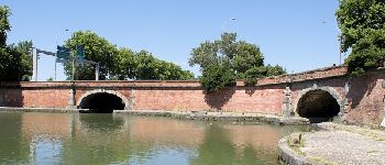
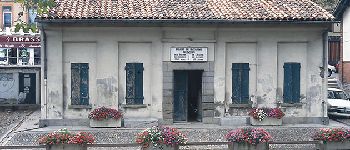
Photos


Positioning
Country:
France
Region :
Occitania
Department/Province :
Haute-Garonne
Municipality :
Toulouse
Location:
Unknown
Start:(Dec)
Start:(UTM)
372506 ; 4829885 (31T) N.
Comments