
Ampus-Spéluque

Sugg
User
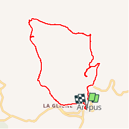


2h54
Difficulty : Easy

FREE GPS app for hiking
 SityTrail
IGN / Geographical institutes
SityTrail Plus
The world is yours!
About
Trail Walking of 10.1 km to be discovered at Provence-Alpes-Côte d'Azur, Var, Ampus. This trail is proposed by Sugg.
Description
10-02-2016
Rando RF avec les groupes 1 et 2.
Temps couvert et un peu frais !
Le pont de Raton, La glacière, le Menhir de Marencq, les charbonnières, Notre Dame de Spéluque, la Nartuby d'Ampus, le chemin de l'eau et le village.
Photos


Positioning
Comments