


chatres

daniel77
User

Length
10.7 km

Max alt
116 m

Uphill gradient
62 m
Km-Effort
11.6 km

Min alt
100 m

Downhill gradient
62 m
Boucle
Yes
Creation date :
2016-03-09 00:00:00.0
Updated on :
2016-03-09 00:00:00.0
2h35
Difficulty : Easy

FREE GPS app for hiking
 SityTrail
IGN / Geographical institutes
SityTrail Plus
The world is yours!
About
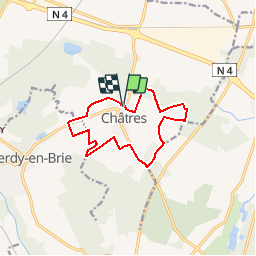
Trail Walking of 10.7 km to be discovered at Ile-de-France, Seine-et-Marne, Châtres. This trail is proposed by daniel77.
Positioning
Country:
France
Region :
Ile-de-France
Department/Province :
Seine-et-Marne
Municipality :
Châtres
Location:
Unknown
Start:(Dec)
Start:(UTM)
485981 ; 5395380 (31U) N.
Comments