


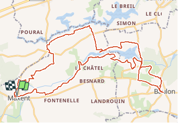
15.02.2016.MAXENT.Tracé virtuel

babeth35
User

Length
29 km

Max alt
124 m

Uphill gradient
342 m
Km-Effort
33 km

Min alt
83 m

Downhill gradient
343 m
Boucle
Yes
Creation date :
2016-03-09 00:00:00.0
Updated on :
2020-07-20 15:39:01.707
7h10
Difficulty : Unknown

FREE GPS app for hiking
 SityTrail
IGN / Geographical institutes
SityTrail Plus
The world is yours!
About
Trail Walking of 29 km to be discovered at Brittany, Ille-et-Vilaine, Maxent. This trail is proposed by babeth35.
Positioning
Country:
France
Region :
Brittany
Department/Province :
Ille-et-Vilaine
Municipality :
Maxent
Location:
Unknown
Start:(Dec)
Start:(UTM)
572086 ; 5314881 (30T) N.
Comments