


Le Chêne à l'image

daniel_2w
User
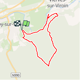

Length
6.6 km

Max alt
313 m

Uphill gradient
219 m
Km-Effort
9.5 km

Min alt
137 m

Downhill gradient
218 m
Boucle
Yes
Creation date :
2016-12-13 00:00:00.0
Updated on :
2018-07-19 13:16:05.539
--
Difficulty : Very easy

FREE GPS app for hiking
 SityTrail
IGN / Geographical institutes
SityTrail Plus
The world is yours!
About
Trail Nordic walking of 6.6 km to be discovered at Wallonia, Namur, Viroinval. This trail is proposed by daniel_2w.
Description
VIROINVAL NORDIC WALKING
Olloy-Sur-Viroin
Rue de la Bossette
GPS:N 50°04.216'-E4°36.869'
Suivre fléchage n°2
Positioning
Country:
Belgium
Region :
Wallonia
Department/Province :
Namur
Municipality :
Viroinval
Location:
Olloy-sur-Viroin
Start:(Dec)
Start:(UTM)
615536 ; 5547693 (31U) N.
Comments