


Trou du diable

daniel_2w
User
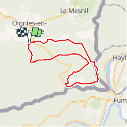

Length
12.8 km

Max alt
391 m

Uphill gradient
345 m
Km-Effort
17.4 km

Min alt
182 m

Downhill gradient
350 m
Boucle
Yes
Creation date :
2016-12-13 00:00:00.0
Updated on :
2018-07-19 13:04:35.71
2h00
Difficulty : Medium

FREE GPS app for hiking
 SityTrail
IGN / Geographical institutes
SityTrail Plus
The world is yours!
About
Trail Nordic walking of 12.8 km to be discovered at Wallonia, Namur, Viroinval. This trail is proposed by daniel_2w.
Description
VIROINVAL NORDIC WALKING
Oignies
Suivre fléchage n° 4
Positioning
Country:
Belgium
Region :
Wallonia
Department/Province :
Namur
Municipality :
Viroinval
Location:
Oignies-en-Thiérache
Start:(Dec)
Start:(UTM)
617504 ; 5541738 (31U) N.
Comments