


montceaux apres midi

daniel77
User

Length
4.8 km

Max alt
171 m

Uphill gradient
62 m
Km-Effort
5.6 km

Min alt
115 m

Downhill gradient
63 m
Boucle
Yes
Creation date :
2016-03-09 00:00:00.0
Updated on :
2016-03-09 00:00:00.0
1h15
Difficulty : Easy

FREE GPS app for hiking
 SityTrail
IGN / Geographical institutes
SityTrail Plus
The world is yours!
About
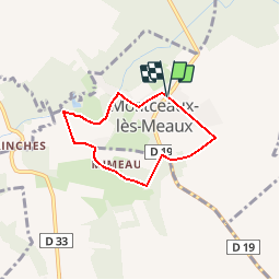
Trail Walking of 4.8 km to be discovered at Ile-de-France, Seine-et-Marne, Montceaux-lès-Meaux. This trail is proposed by daniel77.
Positioning
Country:
France
Region :
Ile-de-France
Department/Province :
Seine-et-Marne
Municipality :
Montceaux-lès-Meaux
Location:
Unknown
Start:(Dec)
Start:(UTM)
499085 ; 5421127 (31U) N.
Comments