


,Morne des Esses - Bezaudin

Lamartiniere
User GUIDE
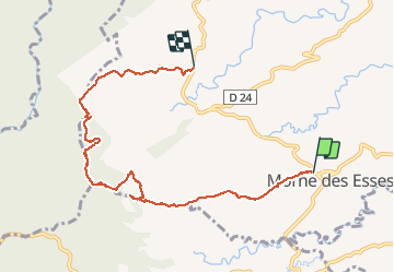

Length
11 km

Max alt
573 m

Uphill gradient
471 m
Km-Effort
17.4 km

Min alt
203 m

Downhill gradient
507 m
Boucle
No
Creation date :
2016-03-19 00:00:00.0
Updated on :
2016-03-19 00:00:00.0
4h10
Difficulty : Unknown

FREE GPS app for hiking
 SityTrail
IGN / Geographical institutes
SityTrail Plus
The world is yours!
About
Trail Walking of 11 km to be discovered at Martinique, Unknown, Sainte-Marie. This trail is proposed by Lamartiniere.
Description
marche moyenne


Positioning
Country:
France
Region :
Martinique
Department/Province :
Unknown
Municipality :
Sainte-Marie
Location:
Unknown
Start:(Dec)
Start:(UTM)
713417 ; 1631101 (20P) N.
Comments