


St Ser - Baudino - Marbrière - Genty

Nathy8913
User
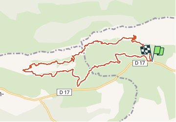

Length
14 km

Max alt
833 m

Uphill gradient
804 m
Km-Effort
25 km

Min alt
405 m

Downhill gradient
803 m
Boucle
Yes
Creation date :
2016-03-24 00:00:00.0
Updated on :
2016-03-24 00:00:00.0
5h23
Difficulty : Medium

FREE GPS app for hiking
 SityTrail
IGN / Geographical institutes
SityTrail Plus
The world is yours!
About
Trail Walking of 14 km to be discovered at Provence-Alpes-Côte d'Azur, Bouches-du-Rhône, Puyloubier. This trail is proposed by Nathy8913.
Description
Très jolie randonnée
Positioning
Country:
France
Region :
Provence-Alpes-Côte d'Azur
Department/Province :
Bouches-du-Rhône
Municipality :
Puyloubier
Location:
Unknown
Start:(Dec)
Start:(UTM)
713617 ; 4822824 (31T) N.
Comments