


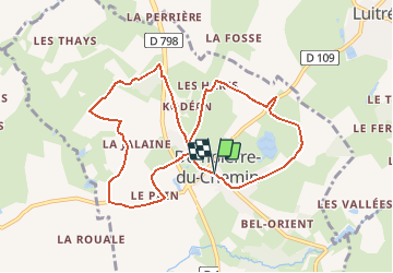
Dompierre du Chemin

neoroll44
User

Length
9.3 km

Max alt
184 m

Uphill gradient
125 m
Km-Effort
10.9 km

Min alt
122 m

Downhill gradient
127 m
Boucle
Yes
Creation date :
2016-03-29 00:00:00.0
Updated on :
2016-03-29 00:00:00.0
2h30
Difficulty : Easy

FREE GPS app for hiking
 SityTrail
IGN / Geographical institutes
SityTrail Plus
The world is yours!
About
Trail Walking of 9.3 km to be discovered at Brittany, Ille-et-Vilaine, Luitré-Dompierre. This trail is proposed by neoroll44.
Description
Circuit des deux châteaux
Positioning
Country:
France
Region :
Brittany
Department/Province :
Ille-et-Vilaine
Municipality :
Luitré-Dompierre
Location:
Dompierre-du-Chemin
Start:(Dec)
Start:(UTM)
637792 ; 5347645 (30U) N.
Comments