


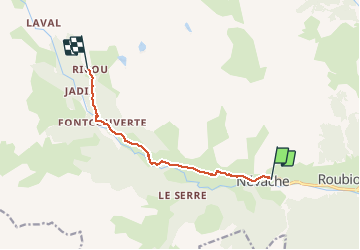
Névache-refuge Ricou

motardes04
User

Length
7.6 km

Max alt
2114 m

Uphill gradient
536 m
Km-Effort
13.1 km

Min alt
1598 m

Downhill gradient
28 m
Boucle
No
Creation date :
2016-04-08 00:00:00.0
Updated on :
2019-08-28 14:49:45.343
2h40
Difficulty : Easy

FREE GPS app for hiking
 SityTrail
IGN / Geographical institutes
SityTrail Plus
The world is yours!
About
Trail Touring skiing of 7.6 km to be discovered at Provence-Alpes-Côte d'Azur, Hautes-Alpes, Névache. This trail is proposed by motardes04.
Description
Ski de rando - CAF 2/4/2016 - Tellement plat que c'est le terrain idéal à ampoules.
Déneigé jusqu'au virage de la chapelle - chalets de Lacou altitude 1755 environ.
Positioning
Country:
France
Region :
Provence-Alpes-Côte d'Azur
Department/Province :
Hautes-Alpes
Municipality :
Névache
Location:
Unknown
Start:(Dec)
Start:(UTM)
311450 ; 4987886 (32T) N.
Comments