


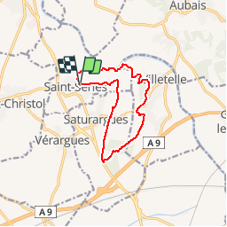
Saint-Series variante 2

philcll
User

Length
11.5 km

Max alt
63 m

Uphill gradient
111 m
Km-Effort
13 km

Min alt
16 m

Downhill gradient
112 m
Boucle
Yes
Creation date :
2016-04-19 00:00:00.0
Updated on :
2016-04-19 00:00:00.0
2h53
Difficulty : Medium

FREE GPS app for hiking
 SityTrail
IGN / Geographical institutes
SityTrail Plus
The world is yours!
About
Trail Walking of 11.5 km to be discovered at Occitania, Hérault, Saint-Sériès. This trail is proposed by philcll.
Positioning
Country:
France
Region :
Occitania
Department/Province :
Hérault
Municipality :
Saint-Sériès
Location:
Unknown
Start:(Dec)
Start:(UTM)
589160 ; 4842712 (31T) N.
Comments