


Le pont de fer sur l'Aille

soca
User
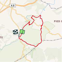

Length
12.9 km

Max alt
109 m

Uphill gradient
122 m
Km-Effort
14.5 km

Min alt
36 m

Downhill gradient
121 m
Boucle
Yes
Creation date :
2016-04-20 00:00:00.0
Updated on :
2016-04-20 00:00:00.0
5h09
Difficulty : Easy

FREE GPS app for hiking
 SityTrail
IGN / Geographical institutes
SityTrail Plus
The world is yours!
About
Trail Walking of 12.9 km to be discovered at Provence-Alpes-Côte d'Azur, Var, Vidauban. This trail is proposed by soca.
Positioning
Country:
France
Region :
Provence-Alpes-Côte d'Azur
Department/Province :
Var
Municipality :
Vidauban
Location:
Unknown
Start:(Dec)
Start:(UTM)
292703 ; 4806355 (32T) N.
Comments
chemin le long de la rivière inexistant.