Trail Walking Débats-Rivière-d'Orpra - Débats Riviere d'Orpra - Photo
 dudu42
dudu42

User

© OpenStreetMap contributors
Length
Length
15.9 km
Max alt
Max alt
912 m
Uphill gradient
Uphill gradient
555 m
Km-Effort
Km-Effort  
23 km
Min alt
Min alt
437 m
Downhill gradient
Downhill gradient
550 m
Boucle
Boucle
Yes
Creation date :
2016-04-24 00:00:00.0
Updated on :
2016-04-24 00:00:00.0

(3 Reviews)

Walking
Walking
3h15
Difficulty : Medium

Scan this QR Code to open this trail in the SityTrail application

FREE GPS app for hiking

Logo SityTrail SityTrail

IGN / Geographical institutes

Download SityTrail from the App Store Download SityTrail from Google Play

Logo SityTrail SityTrail World

The world is yours!

Download SityTrail from the App Store Download SityTrail from Google Play Download SityTrail on Huawei AppGallery

About

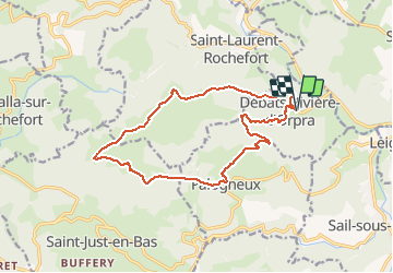
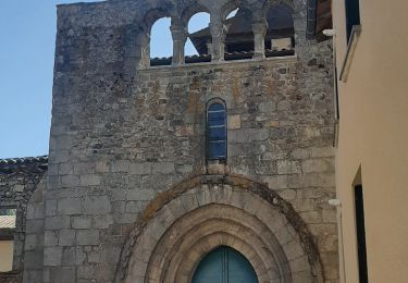
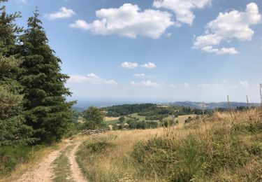
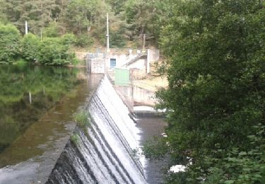
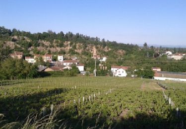
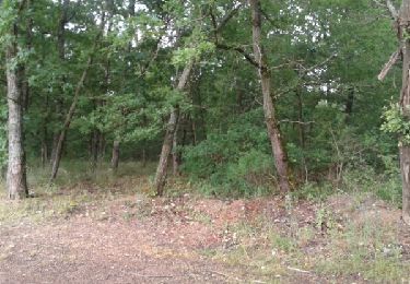
Trail Walking of 15.9 km to be discovered at Auvergne-Rhône-Alpes, Loire, Débats-Rivière-d'Orpra. This trail is proposed by dudu42.

Elevation profile

Photos

Positioning

Country:
France
Region :
Auvergne-Rhône-Alpes
Department/Province :
Loire
Municipality :
Débats-Rivière-d'Orpra
Location:
Unknown
Start:(UTM)
573266 ; 5067766 (31T) N.

Comments

Please log in to post a review or rate the element


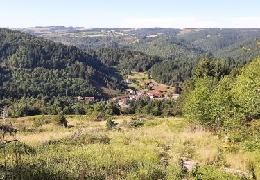
Randonnée très sympa. Un point de pique nique avec vue et un banc. la où a été prise une des photos


Trails nearby

Trail Walking Boën-sur-Lignon - Randonnée entre Boen et Sail sous Couzan  - Photo
Walking
dudu42

Walking

Medium
Boën-sur-Lignon, Auvergne-Rhône-Alpes, Loire, France
17.2 km | 24 km-effort
4h 0min
Yes
Trail Walking Débats-Rivière-d'Orpra - Cascade de Débats-Rivière d'Orpra - Photo
Walking
titanic

Walking

Medium
Débats-Rivière-d'Orpra, Auvergne-Rhône-Alpes, Loire, France
5.8 km | 9.5 km-effort
2h 0min
Yes
Trail Walking L'Hôpital-sous-Rochefort - Hôpital sous rochefort -Salomon_ st sixte - Photo
Walking
titanic

Walking

Medium
L'Hôpital-sous-Rochefort, Auvergne-Rhône-Alpes, Loire, France
7 km | 9.8 km-effort
1h 51min
Yes
Trail On foot Sail-sous-Couzan - Le couzan - Photo
On foot

On foot

Difficult
(1)
Sail-sous-Couzan, Auvergne-Rhône-Alpes, Loire, France
12.8 km | 18.8 km-effort
Unknown
Yes
Trail Other activity Palogneux - Palogneux 25 (a l'envers) - Photo
Other activity
Zeugma13

Other activity

Medium
Palogneux, Auvergne-Rhône-Alpes, Loire, France
10.3 km | 14.8 km-effort
2h 38min
Yes
Trail Walking Boën-sur-Lignon - Boen-Sail le lignon - Photo
Walking
fabrixte

Walking

Medium
(1)
Boën-sur-Lignon, Auvergne-Rhône-Alpes, Loire, France
15.7 km | 23 km-effort
2h 51min
Yes
Trail Walking Boën-sur-Lignon - De Chozieux à Chorigneux - Photo
Walking
fabrixte

Walking

Medium
Boën-sur-Lignon, Auvergne-Rhône-Alpes, Loire, France
15.9 km | 23 km-effort
2h 59min
Yes
Trail Mountain bike Boën-sur-Lignon - Boen Pommiers - Photo
Mountain bike
fabrixte

Mountain bike

Medium
Boën-sur-Lignon, Auvergne-Rhône-Alpes, Loire, France
28 km | 33 km-effort
2h 10min
Yes
Trail Walking Saint-Just-en-Bas - Morière - Photo
Walking
patrando49

Walking

Easy
(1)
Saint-Just-en-Bas, Auvergne-Rhône-Alpes, Loire, France
13.3 km | 20 km-effort
4h 13min
Yes


Close
My subscriptions