


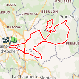
ST CHELY D'APCHER 22 km VTT Apcher (VTopo 14)

benoit48
User

Length
22 km

Max alt
1113 m

Uphill gradient
548 m
Km-Effort
29 km

Min alt
940 m

Downhill gradient
550 m
Boucle
Yes
Creation date :
2018-01-06 00:00:00.0
Updated on :
2018-01-06 00:00:00.0
1h53
Difficulty : Unknown

FREE GPS app for hiking
 SityTrail
IGN / Geographical institutes
SityTrail Plus
The world is yours!
About
Trail Mountain bike of 22 km to be discovered at Occitania, Lozère, Saint-Chély-d'Apcher. This trail is proposed by benoit48.
Positioning
Country:
France
Region :
Occitania
Department/Province :
Lozère
Municipality :
Saint-Chély-d'Apcher
Location:
Unknown
Start:(Dec)
Start:(UTM)
521912 ; 4961075 (31T) N.
Comments