


2 lac blanc la balme

reneperrin
User

Length
12.9 km

Max alt
2359 m

Uphill gradient
968 m
Km-Effort
26 km

Min alt
1437 m

Downhill gradient
1126 m
Boucle
No
Creation date :
2016-05-31 00:00:00.0
Updated on :
2016-05-31 00:00:00.0
5h18
Difficulty : Medium

FREE GPS app for hiking
 SityTrail
IGN / Geographical institutes
SityTrail Plus
The world is yours!
About
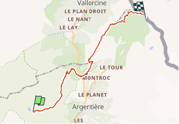
Trail Walking of 12.9 km to be discovered at Auvergne-Rhône-Alpes, Upper Savoy, Chamonix-Mont-Blanc. This trail is proposed by reneperrin.
Description
2è jour : par le GRP, col des Montets,par les crêtes, col de Balme
Positioning
Country:
France
Region :
Auvergne-Rhône-Alpes
Department/Province :
Upper Savoy
Municipality :
Chamonix-Mont-Blanc
Location:
Unknown
Start:(Dec)
Start:(UTM)
336719 ; 5094163 (32T) N.
Comments