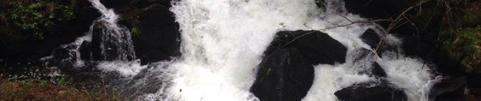
vologne Rocher des bruyères

remysimon
User
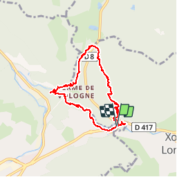

Length
8.8 km

Max alt
925 m

Uphill gradient
290 m
Km-Effort
12.7 km

Min alt
661 m

Downhill gradient
289 m
Boucle
Yes
Creation date :
2016-05-06 00:00:00.0
Updated on :
2016-05-06 00:00:00.0
3h20
Difficulty : Medium

FREE GPS app for hiking
 SityTrail
IGN / Geographical institutes
SityTrail Plus
The world is yours!
About
Trail Other activity of 8.8 km to be discovered at Grand Est, Vosges, Gérardmer. This trail is proposed by remysimon.
Photos


Positioning
Country:
France
Region :
Grand Est
Department/Province :
Vosges
Municipality :
Gérardmer
Location:
Unknown
Start:(Dec)
Start:(UTM)
344328 ; 5327770 (32U) N.
Comments