


St Sauveur d'Emalleville

DDLEDANDY
User
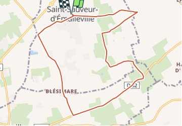

Length
9.9 km

Max alt
140 m

Uphill gradient
85 m
Km-Effort
11.1 km

Min alt
105 m

Downhill gradient
85 m
Boucle
Yes
Creation date :
2016-05-12 00:00:00.0
Updated on :
2022-06-09 11:45:15.685
1h59
Difficulty : Easy

FREE GPS app for hiking
 SityTrail
IGN / Geographical institutes
SityTrail Plus
The world is yours!
About
Trail Walking of 9.9 km to be discovered at Normandy, Seine-Maritime, Saint-Sauveur-d'Émalleville. This trail is proposed by DDLEDANDY.
Positioning
Country:
France
Region :
Normandy
Department/Province :
Seine-Maritime
Municipality :
Saint-Sauveur-d'Émalleville
Location:
Unknown
Start:(Dec)
Start:(UTM)
305199 ; 5499247 (31U) N.
Comments