


Roquefixade

Ajax44
User
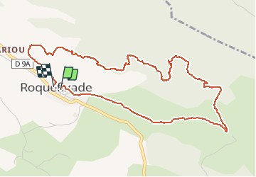

Length
6.2 km

Max alt
989 m

Uphill gradient
244 m
Km-Effort
9.4 km

Min alt
765 m

Downhill gradient
238 m
Boucle
Yes
Creation date :
2016-05-15 00:00:00.0
Updated on :
2016-05-15 00:00:00.0
2h09
Difficulty : Easy

FREE GPS app for hiking
 SityTrail
IGN / Geographical institutes
SityTrail Plus
The world is yours!
About
Trail Walking of 6.2 km to be discovered at Occitania, Ariège, Roquefixade. This trail is proposed by Ajax44.
Positioning
Country:
France
Region :
Occitania
Department/Province :
Ariège
Municipality :
Roquefixade
Location:
Unknown
Start:(Dec)
Start:(UTM)
398491 ; 4754405 (31T) N.
Comments