


Sentier des belvédères Android

i20
User
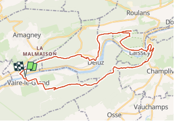

Length
24 km

Max alt
570 m

Uphill gradient
936 m
Km-Effort
37 km

Min alt
244 m

Downhill gradient
936 m
Boucle
Yes
Creation date :
2016-05-26 00:00:00.0
Updated on :
2016-05-26 00:00:00.0
7h35
Difficulty : Medium

FREE GPS app for hiking
 SityTrail
IGN / Geographical institutes
SityTrail Plus
The world is yours!
About
Trail Walking of 24 km to be discovered at Bourgogne-Franche-Comté, Doubs, Vaire. This trail is proposed by i20.
Positioning
Country:
France
Region :
Bourgogne-Franche-Comté
Department/Province :
Doubs
Municipality :
Vaire
Location:
Unknown
Start:(Dec)
Start:(UTM)
284565 ; 5240830 (32T) N.
Comments