


col de l'âne.

aljac
User
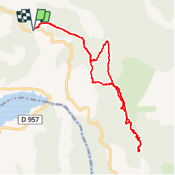

Length
12.5 km

Max alt
1252 m

Uphill gradient
717 m
Km-Effort
22 km

Min alt
672 m

Downhill gradient
718 m
Boucle
Yes
Creation date :
2016-05-28 00:00:00.0
Updated on :
2016-05-28 00:00:00.0
6h20
Difficulty : Unknown

FREE GPS app for hiking
 SityTrail
IGN / Geographical institutes
SityTrail Plus
The world is yours!
About
Trail Other activity of 12.5 km to be discovered at Provence-Alpes-Côte d'Azur, Alpes-de-Haute-Provence, Moustiers-Sainte-Marie. This trail is proposed by aljac.
Positioning
Country:
France
Region :
Provence-Alpes-Côte d'Azur
Department/Province :
Alpes-de-Haute-Provence
Municipality :
Moustiers-Sainte-Marie
Location:
Unknown
Start:(Dec)
Start:(UTM)
278498 ; 4854990 (32T) N.
Comments