


2016-06-14 Annot - Manosque

Lucquiaud
User
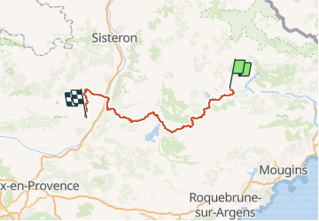

Length
155 km

Max alt
1129 m

Uphill gradient
3037 m
Km-Effort
197 km

Min alt
335 m

Downhill gradient
3347 m
Boucle
No
Creation date :
2018-09-15 15:05:06.487
Updated on :
2018-09-15 15:05:11.221
10h50
Difficulty : Difficult

FREE GPS app for hiking
 SityTrail
IGN / Geographical institutes
SityTrail Plus
The world is yours!
About
Trail Cycle of 155 km to be discovered at Provence-Alpes-Côte d'Azur, Alpes-de-Haute-Provence, Annot. This trail is proposed by Lucquiaud.
Positioning
Country:
France
Region :
Provence-Alpes-Côte d'Azur
Department/Province :
Alpes-de-Haute-Provence
Municipality :
Annot
Location:
Unknown
Start:(Dec)
Start:(UTM)
312847 ; 4870793 (32T) N.
Comments