


LICHTERVELDE

Titounet
User

Length
13.4 km

Max alt
48 m

Uphill gradient
86 m
Km-Effort
14.5 km

Min alt
21 m

Downhill gradient
88 m
Boucle
Yes
Creation date :
2016-06-02 00:00:00.0
Updated on :
2016-06-02 00:00:00.0
3h13
Difficulty : Easy

FREE GPS app for hiking
 SityTrail
IGN / Geographical institutes
SityTrail Plus
The world is yours!
About
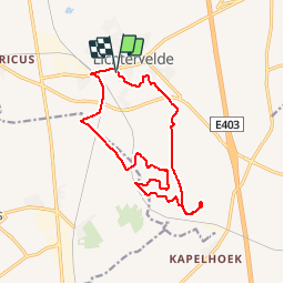
Trail Walking of 13.4 km to be discovered at Flanders, West Flanders, Lichtervelde. This trail is proposed by Titounet.
Positioning
Country:
Belgium
Region :
Flanders
Department/Province :
West Flanders
Municipality :
Lichtervelde
Location:
Lichtervelde
Start:(Dec)
Start:(UTM)
509473 ; 5652617 (31U) N.
Comments