Trail Cycle Roussillon - Parcours n°27 - Roussillon - Photo

Randonnées de Vélo Loisir Provence GUIDE+

© OpenStreetMap contributors
Length
Length
22 km
Max alt
Max alt
322 m
Uphill gradient
Uphill gradient
322 m
Km-Effort
Km-Effort  
26 km
Min alt
Min alt
210 m
Downhill gradient
Downhill gradient
324 m
Boucle
Boucle
Yes
Creation date :
2016-06-13 00:00:00.0
Updated on :
2016-06-13 00:00:00.0

(0 Reviews)

Cycle
Cycle
1h31
Difficulty : Easy

Scan this QR Code to open this trail in the SityTrail application

FREE GPS app for hiking

Logo SityTrail SityTrail

IGN / Geographical institutes

Download SityTrail from the App Store Download SityTrail from Google Play

Logo SityTrail SityTrail World

The world is yours!

Download SityTrail from the App Store Download SityTrail from Google Play Download SityTrail on Huawei AppGallery

About

Trail Cycle of 22 km to be discovered at Provence-Alpes-Côte d'Azur, Vaucluse, Roussillon. This trail is proposed by Vélo Loisir Provence.

Description

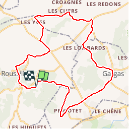
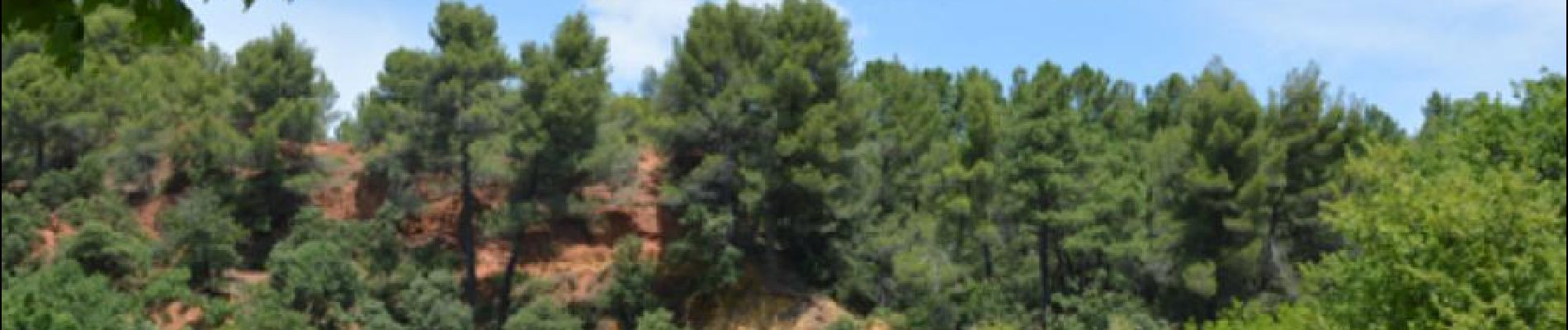
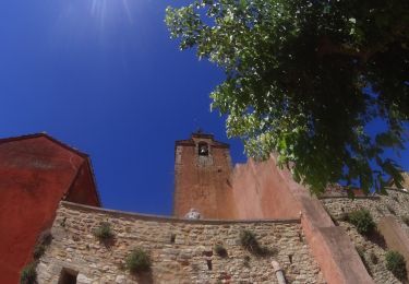
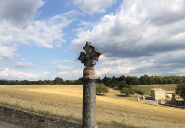
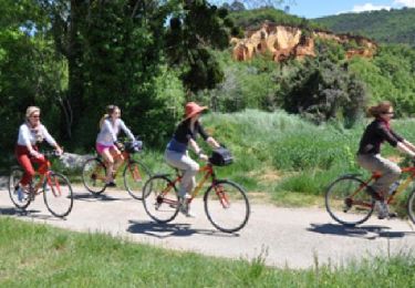
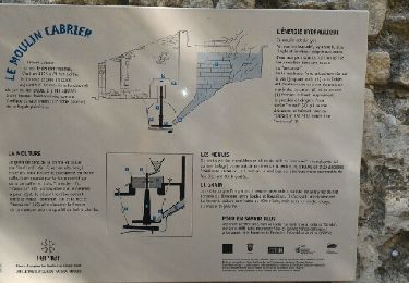
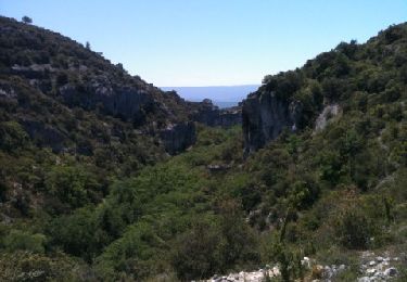
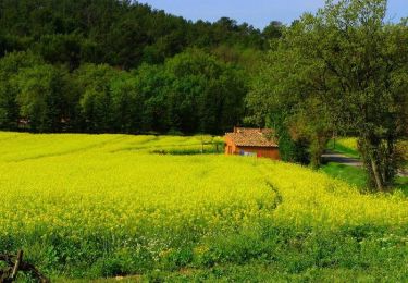
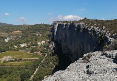
Ochre by bike: 1 route to explore from Roussillon ! The visit to the ancient ochre mills is a fantastic insight into the skills of color creation, with guided visits, work-shop courses, a bookshop and a boutique. From Okhra, take part and explore 1 totally original itinerary, accessible to the whole family (from 12 years old, itinerary of 20 km -12.5 miles each). Experience both the industrial and the human imprints which have made their impact over the centuries. Direction of the itinerary : Roussillon (Okhra) <-> La Tuillère <-> Gargas <-> Le Perrotet <-> Roussillon (Okhra)

Elevation profile

Photos

Positioning

Country:
France
Region :
Provence-Alpes-Côte d'Azur
Department/Province :
Vaucluse
Municipality :
Roussillon
Location:
Unknown
Start:(UTM)
685184 ; 4862907 (31T) N.

Trails nearby

Trail Mountain bike Roussillon - activity_9127223319 - Photo
Mountain bike
GUIDE
pascalou73

Mountain bike

Easy
Roussillon, Provence-Alpes-Côte d'Azur, Vaucluse, France
11.5 km | 15.4 km-effort
1h 4min
No
Trail Walking Joucas - Gorges de Véroncle au départ de Joucas - Photo
Walking
PapouBertrand

Walking

Difficult
Joucas, Provence-Alpes-Côte d'Azur, Vaucluse, France
11.6 km | 16.4 km-effort
3h 43min
Yes
Trail Walking Joucas - Joucas murs  - Photo
Walking
GUIDE
antignacs

Walking

Very easy
Joucas, Provence-Alpes-Côte d'Azur, Vaucluse, France
9.9 km | 13.9 km-effort
2h 35min
Yes
Trail Walking Joucas - Joucas - Les gorges de Véroncle - Photo
Walking
Roulland

Walking

Difficult
Joucas, Provence-Alpes-Côte d'Azur, Vaucluse, France
13.7 km | 19 km-effort
3h 54min
Yes
Trail Cycle Roussillon - Parcours n°28 - Roussillon - Photo
Cycle
GUIDE+

Cycle

Easy
Roussillon, Provence-Alpes-Côte d'Azur, Vaucluse, France
24 km | 28 km-effort
1h 38min
Yes
Trail Walking Joucas - gorges de la veroncle  1er octobre 2015 - Photo
Walking
chrifor

Walking

Medium
Joucas, Provence-Alpes-Côte d'Azur, Vaucluse, France
16.9 km | 22 km-effort
4h 42min
No
Trail Walking Joucas - joucas murs du 2 juin 2013 - Photo
Walking
tvtv84

Walking

Very easy
Joucas, Provence-Alpes-Côte d'Azur, Vaucluse, France
16.7 km | 23 km-effort
5h 35min
Yes
Trail Cycle Roussillon - Circuit Vélo - Les ocres (Itinéraire n°2)  - Roussillon - Photo
Cycle
tracegps

Cycle

Medium
Roussillon, Provence-Alpes-Côte d'Azur, Vaucluse, France
22 km | 26 km-effort
1h 30min
Yes
Trail Walking Lioux - la falaise de la madelaine - Photo
Walking
Vero7684

Walking

Medium
Lioux, Provence-Alpes-Côte d'Azur, Vaucluse, France
13.1 km | 18.4 km-effort
4h 14min
Yes


Close
My subscriptions