


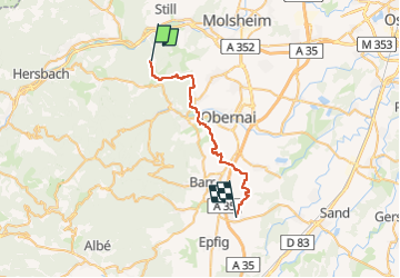
2016-06-18 CVA Sortie Lunaire Mollkirch Stotzheim

holtzv
User GUIDE

Length
27 km

Max alt
396 m

Uphill gradient
290 m
Km-Effort
31 km

Min alt
154 m

Downhill gradient
436 m
Boucle
No
Creation date :
2016-06-19 00:00:00.0
Updated on :
2016-06-19 00:00:00.0
3h52
Difficulty : Medium

FREE GPS app for hiking
 SityTrail
IGN / Geographical institutes
SityTrail Plus
The world is yours!
About
Trail Equestrian of 27 km to be discovered at Grand Est, Bas-Rhin, Mollkirch. This trail is proposed by holtzv.
Positioning
Country:
France
Region :
Grand Est
Department/Province :
Bas-Rhin
Municipality :
Mollkirch
Location:
Unknown
Start:(Dec)
Start:(UTM)
380826 ; 5374054 (32U) N.
Comments