


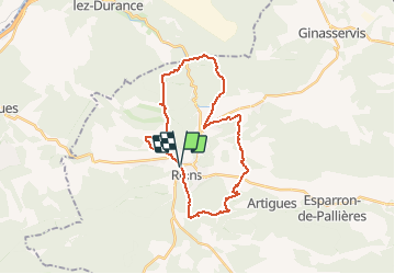
Rians Les Derrots Mont Major Font de Coste

phugues
User

Length
29 km

Max alt
467 m

Uphill gradient
579 m
Km-Effort
37 km

Min alt
292 m

Downhill gradient
576 m
Boucle
Yes
Creation date :
2014-12-10 00:00:00.0
Updated on :
2014-12-10 00:00:00.0
--
Difficulty : Unknown

FREE GPS app for hiking
 SityTrail
IGN / Geographical institutes
SityTrail Plus
The world is yours!
About
Trail Mountain bike of 29 km to be discovered at Provence-Alpes-Côte d'Azur, Var, Rians. This trail is proposed by phugues.
Description
Plus d''infos : http://www.utagawavtt.com/randonnee-vtt-gps?topo=5867
Positioning
Country:
France
Region :
Provence-Alpes-Côte d'Azur
Department/Province :
Var
Municipality :
Rians
Location:
Unknown
Start:(Dec)
Start:(UTM)
722208 ; 4832232 (31T) N.
Comments