


Geneste_Fontaine_Salee_2

jagarnier
User GUIDE
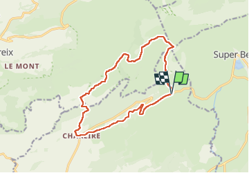

Length
14.9 km

Max alt
1644 m

Uphill gradient
568 m
Km-Effort
22 km

Min alt
1163 m

Downhill gradient
565 m
Boucle
Yes
Creation date :
2016-11-14 00:00:00.0
Updated on :
2025-05-29 05:25:13.719
4h30
Difficulty : Difficult

FREE GPS app for hiking
 SityTrail
IGN / Geographical institutes
SityTrail Plus
The world is yours!
About
Trail Walking of 14.9 km to be discovered at Auvergne-Rhône-Alpes, Puy-de-Dôme, Picherande. This trail is proposed by jagarnier.
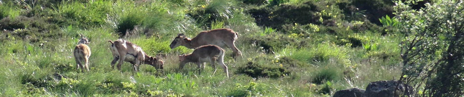
Photos

Positioning
Country:
France
Region :
Auvergne-Rhône-Alpes
Department/Province :
Puy-de-Dôme
Municipality :
Picherande
Location:
Unknown
Start:(Dec)
Start:(UTM)
486165 ; 5038271 (31T) N.
Comments