


chemin des mines et de la galère

amiral13
User GUIDE
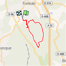

Length
5.9 km

Max alt
363 m

Uphill gradient
111 m
Km-Effort
7.4 km

Min alt
280 m

Downhill gradient
111 m
Boucle
Yes
Creation date :
2016-10-31 00:00:00.0
Updated on :
2016-10-31 00:00:00.0
1h25
Difficulty : Very easy

FREE GPS app for hiking
 SityTrail
IGN / Geographical institutes
SityTrail Plus
The world is yours!
About
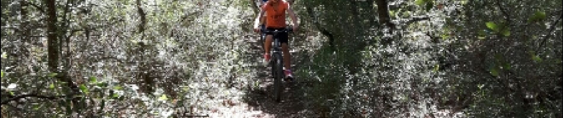
Trail Cycle of 5.9 km to be discovered at Provence-Alpes-Côte d'Azur, Bouches-du-Rhône, Fuveau. This trail is proposed by amiral13.
Photos

Positioning
Country:
France
Region :
Provence-Alpes-Côte d'Azur
Department/Province :
Bouches-du-Rhône
Municipality :
Fuveau
Location:
Unknown
Start:(Dec)
Start:(UTM)
706879 ; 4813564 (31T) N.
Comments