


SENTIER DE L'IMBUT (RETOUR VIDAL)

djeepee74
User

Length
8.9 km

Max alt
949 m

Uphill gradient
844 m
Km-Effort
20 km

Min alt
538 m

Downhill gradient
849 m
Boucle
Yes
Creation date :
2016-06-19 00:00:00.0
Updated on :
2019-04-10 16:13:49.706
4h30
Difficulty : Medium

FREE GPS app for hiking
 SityTrail
IGN / Geographical institutes
SityTrail Plus
The world is yours!
About
Trail Walking of 8.9 km to be discovered at Provence-Alpes-Côte d'Azur, Var, Aiguines. This trail is proposed by djeepee74.
Description
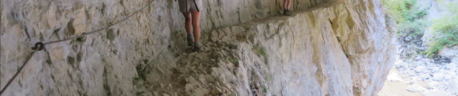
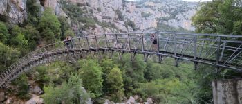
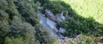
BOUCLE
... Certainement le circuit le plus "sauvage" des gorges du Verdon.
Photos
 - Photo 1")
 - Photo 2")
Positioning
Country:
France
Region :
Provence-Alpes-Côte d'Azur
Department/Province :
Var
Municipality :
Aiguines
Location:
Unknown
Start:(Dec)
Start:(UTM)
286296 ; 4846094 (32T) N.
Comments