Trail Mountain bike Saint-Point-Lac - Tour du Lac de Saint Point - Photo
 Nico222
Nico222

User

© OpenStreetMap contributors
Length
Length
54 km
Max alt
Max alt
1084 m
Uphill gradient
Uphill gradient
1486 m
Km-Effort
Km-Effort  
73 km
Min alt
Min alt
845 m
Downhill gradient
Downhill gradient
1482 m
Boucle
Boucle
Yes
Creation date :
2016-06-27 00:00:00.0
Updated on :
2016-06-27 00:00:00.0

(0 Reviews)

Mountain bike
Mountain bike
5h30
Difficulty : Very difficult

Scan this QR Code to open this trail in the SityTrail application

FREE GPS app for hiking

Logo SityTrail SityTrail

IGN / Geographical institutes

Download SityTrail from the App Store Download SityTrail from Google Play

Logo SityTrail SityTrail World

The world is yours!

Download SityTrail from the App Store Download SityTrail from Google Play Download SityTrail on Huawei AppGallery

About

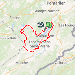
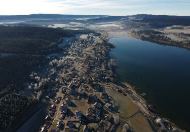
Trail Mountain bike of 54 km to be discovered at Bourgogne-Franche-Comté, Doubs, Saint-Point-Lac. This trail is proposed by Nico222.

Description

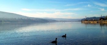
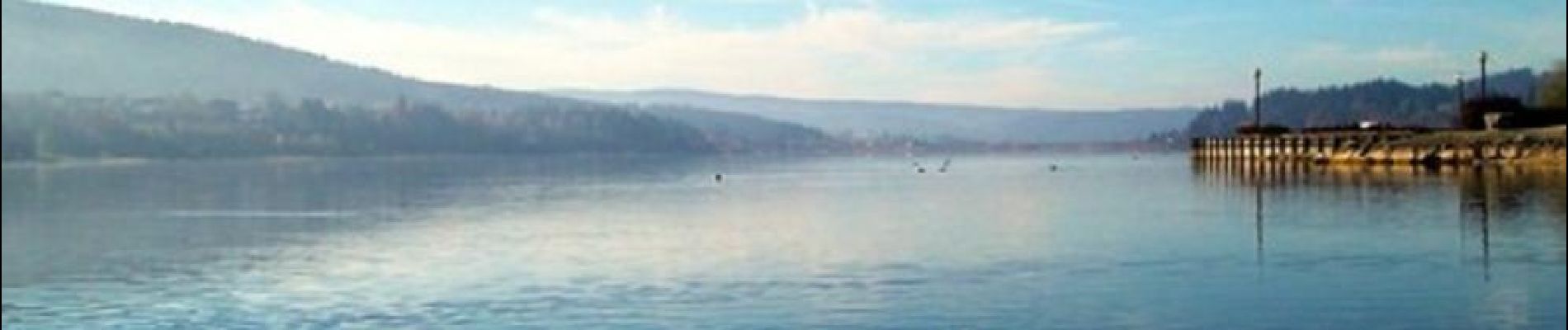
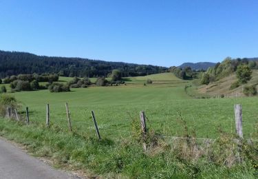
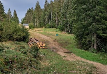
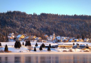
Ce parcours fait le tour des lacs de St-Point et Remoray. C'est l'un des plus beaux et intéressants circuits de la région. On y trouve de tout: Des singles en sous bois, des chemins blancs, des descentes techniques et cassantes parfois. Les paysages sont vraiment magnifiques, on se retrouve a de nombreuses reprises au milieu des champs, des vaches, entourés de sapins, les espaces sont immenses avec en fond l'eau bleue des lacs. Il est préférable de s'y aventurer lorsque le terrain est bien sec, certaines parties risquant d'être boueuses. C'est un tracé difficile, 1400m de dénivelé positif, on a peu de temps pour se reposer, on enchaîne montées et descentes sans vraiment avoir de zone de repos.

Elevation profile

Photos

Points of interest

Point of interest Saint-Point-Lac - Tour du Lac de Saint Point - Photo
Nico222

Positioning

Country:
France
Region :
Bourgogne-Franche-Comté
Department/Province :
Doubs
Municipality :
Saint-Point-Lac
Location:
Unknown
Start:(UTM)
294287 ; 5187891 (32T) N.

Trails nearby

Trail Walking Remoray-Boujeons - Remoray-Boujeons - Le Belvédère des deux Lacs - Photo
Walking
nicolibris

Walking

Difficult
(1)
Remoray-Boujeons, Bourgogne-Franche-Comté, Doubs, France
10.4 km | 13.8 km-effort
2h 58min
Yes
Trail Walking Remoray-Boujeons - Le Belvédère des 2 lacs - Doubs - Photo
Walking
tracegps

Walking

Difficult
(1)
Remoray-Boujeons, Bourgogne-Franche-Comté, Doubs, France
13.7 km | 19 km-effort
4h 0min
Yes
Trail Walking Métabief - GTJ  Metabief - Pontarlier - Photo
Walking
svp59

Walking

Medium
(1)
Métabief, Bourgogne-Franche-Comté, Doubs, France
25 km | 35 km-effort
7h 17min
No
Trail Walking Saint-Antoine - Boucle du fort St Antoine  - Photo
Walking
mallovon

Walking

Medium
Saint-Antoine, Bourgogne-Franche-Comté, Doubs, France
4.8 km | 6.2 km-effort
1h 25min
Yes
Trail On foot Saint-Point-Lac - La Ronde des Deux Villages - Photo
On foot
PRO

On foot

Easy
Saint-Point-Lac, Bourgogne-Franche-Comté, Doubs, France
5.5 km | 7.3 km-effort
1h 40min
Yes
Trail On foot Les Grangettes - La Pierre qui Tourne - Photo
On foot
PRO

On foot

Easy
Les Grangettes, Bourgogne-Franche-Comté, Doubs, France
8.2 km | 10.7 km-effort
2h 25min
Yes
Trail On foot Malpas - Le Tour du Lac de Malpas - Photo
On foot
PRO

On foot

Easy
Malpas, Bourgogne-Franche-Comté, Doubs, France
4.9 km | 5.7 km-effort
1h 17min
Yes
Trail On foot Malbuisson - Sentier du Tour du Lac - Photo
On foot
PRO

On foot

Easy
Malbuisson, Bourgogne-Franche-Comté, Doubs, France
16 km | 19.9 km-effort
4h 30min
No
Trail Nordic walking Malbuisson - Fort St Antoine  - Photo
Nordic walking
mallovon

Nordic walking

Easy
Malbuisson, Bourgogne-Franche-Comté, Doubs, France
5.8 km | 7.3 km-effort
2h 21min
Yes


Close
My subscriptions