


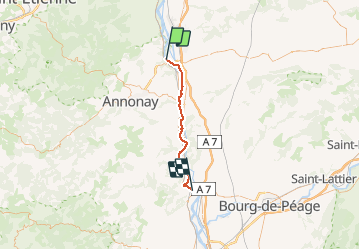
sablons_tournon_parcours

henzmannp
User

Length
37 km

Max alt
145 m

Uphill gradient
222 m
Km-Effort
40 km

Min alt
116 m

Downhill gradient
239 m
Boucle
No
Creation date :
2016-06-25 00:00:00.0
Updated on :
2016-06-25 00:00:00.0
--
Difficulty : Medium

FREE GPS app for hiking
 SityTrail
IGN / Geographical institutes
SityTrail Plus
The world is yours!
About
Trail Cycle of 37 km to be discovered at Auvergne-Rhône-Alpes, Isère, Sablons. This trail is proposed by henzmannp.
Positioning
Country:
France
Region :
Auvergne-Rhône-Alpes
Department/Province :
Isère
Municipality :
Sablons
Location:
Unknown
Start:(Dec)
Start:(UTM)
638587 ; 5019887 (31T) N.
Comments