


Brissac - abime Rabanel - Roc Blanc - Notre-Dame-du-Suc

vertygo
User
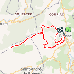

Length
18.2 km

Max alt
912 m

Uphill gradient
841 m
Km-Effort
29 km

Min alt
134 m

Downhill gradient
841 m
Boucle
Yes
Creation date :
2017-03-21 00:00:00.0
Updated on :
2017-03-21 00:00:00.0
6h07
Difficulty : Medium

FREE GPS app for hiking
 SityTrail
IGN / Geographical institutes
SityTrail Plus
The world is yours!
About
Trail Walking of 18.2 km to be discovered at Occitania, Hérault, Brissac. This trail is proposed by vertygo.
Description
voir des photos sur www.vertygo.org
https://goo.gl/photos/RYpRPixy7UXALxN97
Positioning
Country:
France
Region :
Occitania
Department/Province :
Hérault
Municipality :
Brissac
Location:
Unknown
Start:(Dec)
Start:(UTM)
556344 ; 4858595 (31T) N.
Comments
compter plutôt 20 kms et 1000 D+