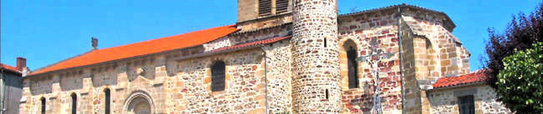
Brousse_Montboissier

jagarnier
User GUIDE
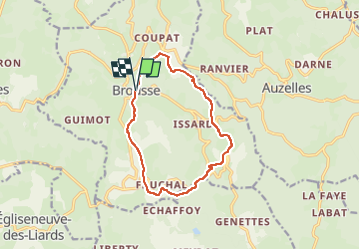


3h45
Difficulty : Medium

FREE GPS app for hiking
 SityTrail
IGN / Geographical institutes
SityTrail Plus
The world is yours!
About
Trail Walking of 11.4 km to be discovered at Auvergne-Rhône-Alpes, Puy-de-Dôme, Brousse. This trail is proposed by jagarnier.
Description
Montboissier, "la montagne aux buis" n'est plus aujourd'hui qu'un hameau de Brousse.C'est pourtant sur cette assise basaltique que s'éleva le puissant château fort qui donna son nom à l'une des familles nobles du pays. De Montboissier à l'Ailloux le plateau cristallin s'incline entrainant d'importantes variations climatiques, voire un décalage des saisons.
Photos

Positioning
Comments