Sauxillanges_Ventre

jagarnier
User GUIDE
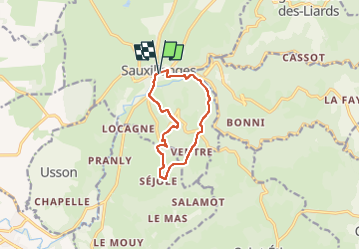

Length
9.2 km

Max alt
652 m

Uphill gradient
317 m
Km-Effort
13.4 km

Min alt
439 m

Downhill gradient
315 m
Boucle
Yes
Creation date :
2016-09-09 00:00:00.0
Updated on :
2023-04-10 12:59:26.207
2h45
Difficulty : Medium

FREE GPS app for hiking
 SityTrail
IGN / Geographical institutes
SityTrail Plus
The world is yours!
About
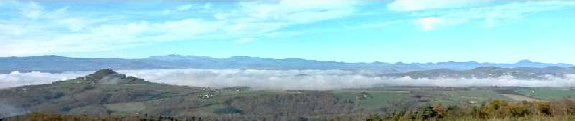
Trail Walking of 9.2 km to be discovered at Auvergne-Rhône-Alpes, Puy-de-Dôme, Sauxillanges. This trail is proposed by jagarnier.
Description
Belle randonnée sous le signe de l'eau et de ses nombreux usages, qui appartiennent désormais au patrimoine collectif.
Photos

Positioning
Country:
France
Region :
Auvergne-Rhône-Alpes
Department/Province :
Puy-de-Dôme
Municipality :
Sauxillanges
Location:
Unknown
Start:(Dec)
Start:(UTM)
529090 ; 5044252 (31T) N.
Comments