


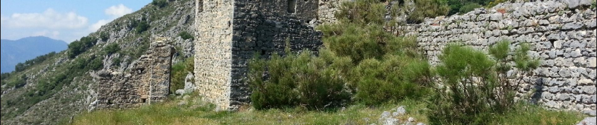
Cayrosina (Fontan) - Chateau de Malmort - pont de Gafeug

Orcal37
User GUIDE
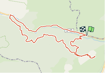

Length
16.7 km

Max alt
974 m

Uphill gradient
944 m
Km-Effort
29 km

Min alt
445 m

Downhill gradient
954 m
Boucle
Yes
Creation date :
2016-07-14 00:00:00.0
Updated on :
2021-09-16 16:30:27.652
7h00
Difficulty : Difficult

FREE GPS app for hiking
 SityTrail
IGN / Geographical institutes
SityTrail Plus
The world is yours!
About
Trail Walking of 16.7 km to be discovered at Provence-Alpes-Côte d'Azur, Maritime Alps, Fontan. This trail is proposed by Orcal37.
Description
Hameau Cayrosina (Fontan) - Chateau de Malmort - pont de Gafeug
Photos
 - Chateau de Malmort - pont de Gafeug - Photo 1")
 - Chateau de Malmort - pont de Gafeug - Photo 2")
 - Chateau de Malmort - pont de Gafeug - Photo 3")
 - Chateau de Malmort - pont de Gafeug - Photo 4")
 - Chateau de Malmort - pont de Gafeug - Photo 5")
 - Chateau de Malmort - pont de Gafeug - Photo 6")
Positioning
Country:
France
Region :
Provence-Alpes-Côte d'Azur
Department/Province :
Maritime Alps
Municipality :
Fontan
Location:
Unknown
Start:(Dec)
Start:(UTM)
382562 ; 4872284 (32T) N.
Comments