


Vaux de Cernay par les Vindrins

fpolini
User
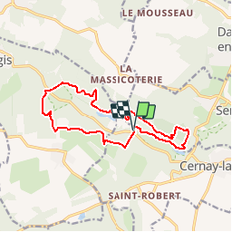

Length
13.4 km

Max alt
187 m

Uphill gradient
260 m
Km-Effort
16.8 km

Min alt
123 m

Downhill gradient
264 m
Boucle
Yes
Creation date :
2016-03-17 00:00:00.0
Updated on :
2016-03-17 00:00:00.0
3h41
Difficulty : Easy

FREE GPS app for hiking
 SityTrail
IGN / Geographical institutes
SityTrail Plus
The world is yours!
About
Trail Walking of 13.4 km to be discovered at Ile-de-France, Yvelines, Cernay-la-Ville. This trail is proposed by fpolini.
Positioning
Country:
France
Region :
Ile-de-France
Department/Province :
Yvelines
Municipality :
Cernay-la-Ville
Location:
Unknown
Start:(Dec)
Start:(UTM)
422115 ; 5392635 (31U) N.
Comments