


au-dessus de la Chiappera - granges Collet - Col Maurin - sous la Tête du Cialancioun

vertygo
User
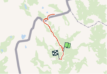

Length
12.7 km

Max alt
2768 m

Uphill gradient
684 m
Km-Effort
22 km

Min alt
1923 m

Downhill gradient
849 m
Boucle
No
Creation date :
2017-04-04 00:00:00.0
Updated on :
2017-04-04 00:00:00.0
4h30
Difficulty : Medium

FREE GPS app for hiking
 SityTrail
IGN / Geographical institutes
SityTrail Plus
The world is yours!
About
Trail Walking of 12.7 km to be discovered at Piemont, Cuneo, Acceglio. This trail is proposed by vertygo.
Description
voir des photos et d'autres randonnées sur www.vertygo.org
https://goo.gl/photos/37f2VaiNoEfQU56Y9
Positioning
Country:
Italy
Region :
Piemont
Department/Province :
Cuneo
Municipality :
Acceglio
Location:
Unknown
Start:(Dec)
Start:(UTM)
333891 ; 4932511 (32T) N.
Comments