


St André de Sangonis-Avène

ARVIEU
User

Length
124 km

Max alt
830 m

Uphill gradient
2362 m
Km-Effort
155 km

Min alt
48 m

Downhill gradient
2363 m
Boucle
No
Creation date :
2016-07-30 00:00:00.0
Updated on :
2016-07-30 00:00:00.0
8h42
Difficulty : Medium

FREE GPS app for hiking
 SityTrail
IGN / Geographical institutes
SityTrail Plus
The world is yours!
About
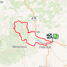
Trail Cycle of 124 km to be discovered at Occitania, Hérault, Saint-André-de-Sangonis. This trail is proposed by ARVIEU.
Positioning
Country:
France
Region :
Occitania
Department/Province :
Hérault
Municipality :
Saint-André-de-Sangonis
Location:
Unknown
Start:(Dec)
Start:(UTM)
540308 ; 4833176 (31T) N.
Comments