


OCC 2016

jybouteyre
User
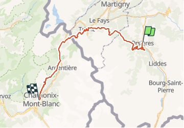

Length
53 km

Max alt
2071 m

Uphill gradient
3457 m
Km-Effort
99 km

Min alt
891 m

Downhill gradient
3307 m
Boucle
No
Creation date :
2016-07-30 00:00:00.0
Updated on :
2016-07-30 00:00:00.0
10h00
Difficulty : Very difficult

FREE GPS app for hiking
 SityTrail
IGN / Geographical institutes
SityTrail Plus
The world is yours!
About
Trail Running of 53 km to be discovered at Valais/Wallis, Entremont, Orsières. This trail is proposed by jybouteyre.
Positioning
Country:
Switzerland
Region :
Valais/Wallis
Department/Province :
Entremont
Municipality :
Orsières
Location:
Unknown
Start:(Dec)
Start:(UTM)
356543 ; 5099095 (32T) N.
Comments