


Compostelle : 2- St Didier d'Allier - Villefranche-de-Rouergue

prv
User
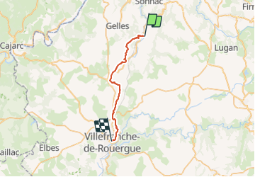

Length
26 km

Max alt
412 m

Uphill gradient
544 m
Km-Effort
33 km

Min alt
234 m

Downhill gradient
513 m
Boucle
No
Creation date :
2016-07-31 00:00:00.0
Updated on :
2016-07-31 00:00:00.0
6h08
Difficulty : Unknown

FREE GPS app for hiking
 SityTrail
IGN / Geographical institutes
SityTrail Plus
The world is yours!
About
Trail Walking of 26 km to be discovered at Occitania, Aveyron, Naussac. This trail is proposed by prv.
Description
St Jacques de Compostelle Via Podiensis
Photos


Positioning
Country:
France
Region :
Occitania
Department/Province :
Aveyron
Municipality :
Naussac
Location:
Unknown
Start:(Dec)
Start:(UTM)
428578 ; 4927696 (31T) N.
Comments