Compostelle 2: 4-St Cirq Lapopie - Vers

prv
User

Length
23 km

Max alt
356 m

Uphill gradient
738 m
Km-Effort
33 km

Min alt
120 m

Downhill gradient
797 m
Boucle
No
Creation date :
2016-07-31 00:00:00.0
Updated on :
2016-07-31 00:00:00.0
6h28
Difficulty : Unknown

FREE GPS app for hiking
 SityTrail
IGN / Geographical institutes
SityTrail Plus
The world is yours!
About
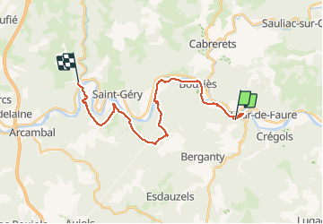
Trail Walking of 23 km to be discovered at Occitania, Lot, Saint-Cirq-Lapopie. This trail is proposed by prv.
Description
St Jacques de Compostelle par la vallée du Célé
Positioning
Country:
France
Region :
Occitania
Department/Province :
Lot
Municipality :
Saint-Cirq-Lapopie
Location:
Unknown
Start:(Dec)
Start:(UTM)
394288 ; 4924327 (31T) N.
Comments