


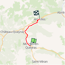
Molines - Aiguilles

rochedaniel
User

Length
9.7 km

Max alt
1749 m

Uphill gradient
92 m
Km-Effort
11.8 km

Min alt
1445 m

Downhill gradient
358 m
Boucle
No
Creation date :
2016-08-01 00:00:00.0
Updated on :
2016-08-01 00:00:00.0
1h58
Difficulty : Very easy

FREE GPS app for hiking
 SityTrail
IGN / Geographical institutes
SityTrail Plus
The world is yours!
About
Trail Walking of 9.7 km to be discovered at Provence-Alpes-Côte d'Azur, Hautes-Alpes, Molines-en-Queyras. This trail is proposed by rochedaniel.
Description
En pente douce
Photos


Positioning
Country:
France
Region :
Provence-Alpes-Côte d'Azur
Department/Province :
Hautes-Alpes
Municipality :
Molines-en-Queyras
Location:
Unknown
Start:(Dec)
Start:(UTM)
329225 ; 4955103 (32T) N.
Comments