


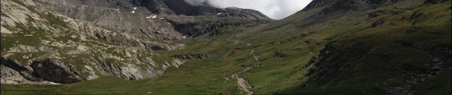
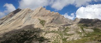
col vieux et lac Foréant

rochedaniel
User
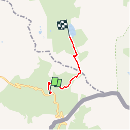

Length
2.9 km

Max alt
2809 m

Uphill gradient
176 m
Km-Effort
5.3 km

Min alt
2622 m

Downhill gradient
178 m
Boucle
No
Creation date :
2016-08-09 00:00:00.0
Updated on :
2016-08-09 00:00:00.0
1h05
Difficulty : Easy

FREE GPS app for hiking
 SityTrail
IGN / Geographical institutes
SityTrail Plus
The world is yours!
About
Trail Walking of 2.9 km to be discovered at Provence-Alpes-Côte d'Azur, Hautes-Alpes, Molines-en-Queyras. This trail is proposed by rochedaniel.
Description
très fréquenté
Photos


Positioning
Country:
France
Region :
Provence-Alpes-Côte d'Azur
Department/Province :
Hautes-Alpes
Municipality :
Molines-en-Queyras
Location:
Unknown
Start:(Dec)
Start:(UTM)
339627 ; 4950566 (32T) N.
Comments