


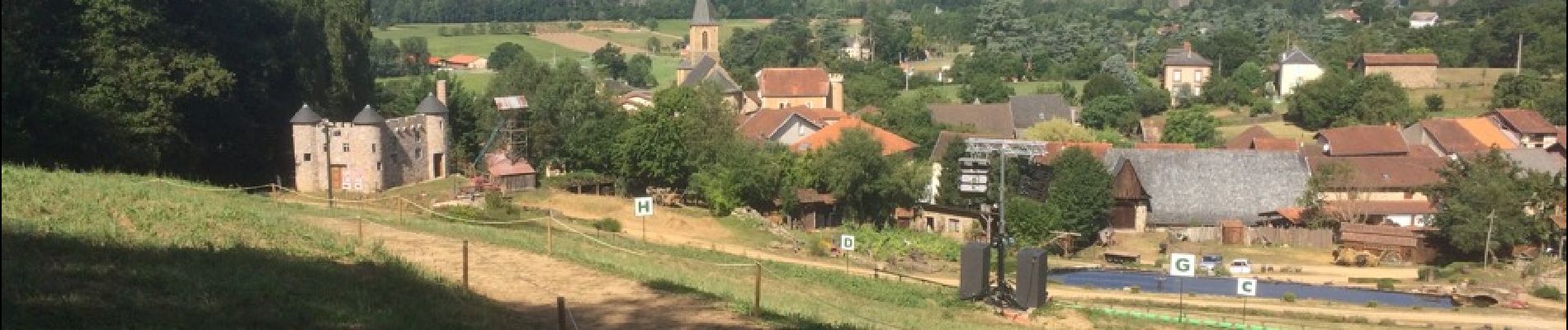
Tour Flagnac

j.pont
User
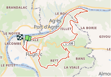

Length
12 km

Max alt
353 m

Uphill gradient
318 m
Km-Effort
16.3 km

Min alt
186 m

Downhill gradient
312 m
Boucle
Yes
Creation date :
2016-08-17 00:00:00.0
Updated on :
2016-08-17 00:00:00.0
1h08
Difficulty : Medium

FREE GPS app for hiking
 SityTrail
IGN / Geographical institutes
SityTrail Plus
The world is yours!
About
Trail Mountain bike of 12 km to be discovered at Occitania, Aveyron, Flagnac. This trail is proposed by j.pont.
Photos


Positioning
Country:
France
Region :
Occitania
Department/Province :
Aveyron
Municipality :
Flagnac
Location:
Unknown
Start:(Dec)
Start:(UTM)
439813 ; 4939609 (31T) N.
Comments