


Prapic Dormillouse

ARPF
User
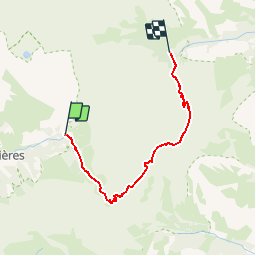

Length
18.4 km

Max alt
2725 m

Uphill gradient
1206 m
Km-Effort
34 km

Min alt
1572 m

Downhill gradient
1101 m
Boucle
No
Creation date :
2016-08-06 00:00:00.0
Updated on :
2016-08-06 00:00:00.0
6h59
Difficulty : Difficult

FREE GPS app for hiking
 SityTrail
IGN / Geographical institutes
SityTrail Plus
The world is yours!
About
Trail Walking of 18.4 km to be discovered at Provence-Alpes-Côte d'Azur, Hautes-Alpes, Orcières. This trail is proposed by ARPF.
Positioning
Country:
France
Region :
Provence-Alpes-Côte d'Azur
Department/Province :
Hautes-Alpes
Municipality :
Orcières
Location:
Unknown
Start:(Dec)
Start:(UTM)
291682 ; 4952290 (32T) N.
Comments