


Monte Tolu 2

soca
User
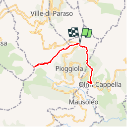

Length
13.5 km

Max alt
1292 m

Uphill gradient
569 m
Km-Effort
21 km

Min alt
826 m

Downhill gradient
571 m
Boucle
Yes
Creation date :
2017-09-10 00:00:00.0
Updated on :
2017-09-10 00:00:00.0
5h00
Difficulty : Easy

FREE GPS app for hiking
 SityTrail
IGN / Geographical institutes
SityTrail Plus
The world is yours!
About
Trail Walking of 13.5 km to be discovered at Corsica, Haute-Corse, Pioggiola. This trail is proposed by soca.
Positioning
Country:
France
Region :
Corsica
Department/Province :
Haute-Corse
Municipality :
Pioggiola
Location:
Unknown
Start:(Dec)
Start:(UTM)
500441 ; 4710817 (32T) N.
Comments